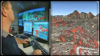
ArcGIS provides a scalable application - can be tailored to the abilities and needs of its users - which could be implemented for single users as well as multiusers in desktop applications, servers, and internet. ArcGIS is a collection of 10 software products GIS (Geographic Information System) to build a comprehensive GIS applications. ArcGIS 10 can dbagi into several parts:
- ArcGIS Desktop: desktop-based GIS applications.
- ArcGIS Engine: various components to create their own GIS applications.
- Server GIS: a collection of server-based GIS applications (ArcSDE, ArcIMS, ArcGIS Server).
- Mobile GIS: GIS applications for mobile devices (ArcPad).
ArcGIS Desktop is one part of 10 is used for ArcGIS mapping, analysis, editing, data management, visualization, and geoprocessing. ArcGIS Desktop consists of several applications: ArcMap, ArcCatalog, ArcToolbox, ArcGlobe, ArcScene, ModelBuilder. ArcGIS Desktop has three functional levels: ArcView, ArcEditor, and ArcInfo - which can be customized according to user's needs and abilities.
ArcGIS can menngakses data in various formats and using a multi-database and data-based files simultaneously. Data files are backed-based ArcGIS include: coverages, shapefile, Grids, TIN, images, etc.. Moreover, in line with technological advances, developing ArcGIS geodatabase format for the storage of spatial data. Geodatabase using relational database technology for spatial data management so that the various advantages of RDBMS (Relational DataBase Management System) can be applied in spatial data management.
There are two types of Geodatabase: Geodatabase and Personal Geodatabase multiusers. Personal Geodatabase is used to store data that is relatively small (max.2GB), using a Microsoft Access database, a single-user editing. ArcSDE geodatabase multiusers needs and work with various models of DBMS (IBM DB2, Informix, Oracle, and SQL Server), a very large storage capacity, multiusers editing.
ArcGIS Desktop has three frequently used applications: ArcCatalog, ArcMap, ArcToolbox.
- ArcCatalog: functions to access and manage data management (non-spatial data and spatial) with ease. Users can search for desired data, display, view, or create metadata. ArcCatalog can also connect an external database (MS Access, SQL Server, Oracle, etc.) with the data already held.
- ArcMap: designed for data display, editing, printing high-quality maps and perform spatial analysis.
- ArcToolbox: contains tools (tools) for various geoprocessing as well as conversion between data formats.


