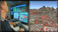
Free ArGIS Tutorial Basic

Diposting oleh Unknown


ArcGIS Tutorial is highly sought by those who want to learn ArcGIS independently. On the mailing list several times a member rsgisforum also questioned it. A search on Google with keywords "ArcGIS Tutorial" always found the foreign-language tutorial (English), while the needs of those who are looking for is in the Indonesian language.


A friend gave me ArcGIS module created by GIS Consortium team Aceh Nias. And the best part of this module is in Bahasa Indonesia. You can see on the front cover right?

ArcGIS Tutorial contents in Indonesian language is quite complete for the basic level (Basic). To detail the contents of this tutorial, I quote the following table of contents, which I took from the module.

CHAPTER I. GEOGRAPHIC INFORMATION SYSTEM

CHAPTER II. INTRODUCTION ArcMap

CHAPTER III. INTRODUCTION ArcCATALOG

CHAPTER IV. rectification

CHAPTER V. MAKE A SPATIAL DATA

CHAPTER VI. Vector data editing

CHAPTER VII. FEATURING SPATIAL DATA

CHAPTER VIII. DATA QUERY

CHAPTER IX. MAP LAYOUT AND PRINTING

CHAPTER 10. SOURCE OF DATA IN ArcGIS

Then Bagimana and where can I get it? Maybe you like it .. pertanyan I myself hesitated to publish it to the public via the internet so that all who need it can get. But with my intention to divide and principled "Not In Eat Yourself" then the module Basic language Tutorial ArcGIS Indonesia is my share to my friends in need. Previously I apologize if anyone objected to what I'm doing this.
Can you see the download link at the end of this post, I was also shared modules made ​​my own ArcView 3.3. I also intend even harder to write about GIS tips and tricks in this blog, because it's been a long time I did not write in this blog. OK, I hope useful ...


More aboutFree ArGIS Tutorial Basic

IS MUCH SENSING SATELLITE

Diposting oleh Unknown

I. Definitions and Basic Concepts

Remote sensing is the science, technology and art data acquisition and data processing to record the interaction between electromagnetic energy to an object. In other words can be defined as the science, technology and art of obtaining information about an object, area, or phenomenon through the analysis of data obtained with an instrument without direct contact with the object, area, or phenomenon under review.


In general, remote sensing showed activity recording, observation and capture the phenomenon of objects or events from a certain distance. In Is Much far, the sensor does not directly contact with the object being observed. Conductor means that information needs to physically travel from the object to the sensor through the medium.

Tutorial on training is more limited remote sensing technology to obtain information on the Earth's surface (sea and land) by using a sensor on the satellite platform and Spaceborne (spacecraft).
More aboutIS MUCH SENSING SATELLITE

Creating Your Own Using Toolbox ArcGIS10

Diposting oleh Unknown

ArcToolbox has a very important function in the operation of ArcGIS. If we have an ArcInfo license we will have lots of tools in ArcToolbox. However, because there were so many, sometimes we are having trouble finding the tools that we want to use. The following tutorial shows how to create and manage your own toolbox.


  1. Open ArcMap (or ArcCatalog)
  2. Activate the ArcToolbox window
  3. Right click on the folder indux ArcToolbox>
  4. Navigate to the folder where it saved our toolbox
  5. Click on the New Toolbox
  6. Give the name, for example gistutorial.tbx


Note: If you want to be at the top of our toolbox, use the number before the name of the toolbox, for example 1gistutorial.tbx

7. Select the toolbox> Open

8. Right click on the toolbox that was made> New> toolset


9. Create a toolset as follows

10. Copy and Paste toolbar from ESRI standard toolbar into the toolset that we have made


All the tools are often used we put on a toolset that we have made.

11. Save the toolbox to the file

To save the toolbox to the file can be done by right click on toolbox 1gistutorial> Save As

Note: Toolbox refers to the file (Step 6). If the toolbox file was moved, it needs to be added back into the project.


More aboutCreating Your Own Using Toolbox ArcGIS10

Electromagnetic Energy in Remote Sensing Satellite

Diposting oleh Unknown

Visible light is one of several forms of electromagnetic energy, radio waves, ultraviolet rays and X rays are also other forms of energy are prevalent.


Figure: Illustration of recording a variety of phenomena that exist on the surface using remote sensing technology.


Basically, all the energy is the same and perform in accordance with the basic theory of radiation waves. In Figure 1. demonstrated the basic theory of electromagnetic energy that moves in harmony with the sinusoidal shape of the speed of light c. Based on the concept of basic physics, the wave has the following general equation:


C  =  f  x  l

c  =  speed of light (3 x 10⁸ m / sec)
f   =  frequency
l  =  wavelength


Picture: Electromagnetic waves with components including electrical sinusoidal wave (E) and magnetic sinusoidal wave (M).

In the satellite remote sensing, electromagnetic wave grouping most commonly used wavelength is placed in position in the electromagnetic spectrum (Fig. 2.).


Figure 2. electromagnetic spectrum

Name of the spectrum is usually used in the electromagnetic spectrum, such as infrared waves, radio waves, microwaves, and so forth. And the spectrum has no clear boundaries between one part of the spectrum with the spectrum of the next one .. Part of the visible spectrum ( 0.4 to 0.7 μm) on a logarithmic image is part of a narrow, has a sensitivity to the human eye

The nature of electromagnetic radiation more easily described by using the wave theory, but the interaction between electromagnetic energy with matter can be explained by the theory of particles. Particle theory states that electromagnetic radiation consists of several separate parts are referred to as photons. The relationship between the wave theory with quantum theory in the behavior of electromagnetic radiation can be explained by the following equation:

E  =  hc / l

So it can be said the longer the wavelength used the lower energy content.


More aboutElectromagnetic Energy in Remote Sensing Satellite

5 skills required for success in the field of GIS

Diposting oleh Unknown


ESRI Education Manager, Joseph Kerski, wrote an article about the five skills or abilities needed for a successful career in the field of GIS. To-5 expertise or skill is 2 or 3 of them are also must-have skills for successful careers in other fields. So what skill or skills are they?


The first skill for a successful career in the field of GIS is curiosity or the curiosity / wonder is great. They are a successful career in the field of GIS is not only curious about the world of geospatial technologies, but they also want to know about the world itself. They reflect the spatial relationship to work in a local phenomenon to a global scale, ranging from demographics, land use and traffic patterns within their own communities to natural hazards, biodiversity, and climate around the world. This triggers the curiosity that is often necessary to solve the problem by using GIS.

The second skill is the ability to work with data. They are a successful career in the field of GIS has developed the skills to think critically about the data. They not only know where to find data, but with a very good understanding of metadata so that they know the benefits and limitations to work with any kind of data type. They understand well what is the most effective measures to collect, analyze, and display geographic data in the application / GIS software.

The third skill for a successful career in the field of GIS is a basic understanding of geography. GIS practitioners must know the fundamentals behind all spatial phenomena, including map projections, datums, topological relations, spatial data models, database theory and methodology, ways to classify data, how to effectively use spatial statistics and geoprocessing methods, and much more the other.

The ability to adapt quickly is the fourth skill necessary to succeed in the field of GIS. Now this geospatial technology is developing very fast, as fast as other technologies. Cloud computing technology, the choice of GIS data access via the desktop platform or mobile device, access data online is the latest technological developments, as a professional career in the field of GIS, adaptation to technology and flexibility in the application of technology should be a must-have their own skills. This also applies to a successful career in other technologies. Inevitably, they must not only willing to change, but accept and embrace change as an important part of their careers. They are lifelong learners.

The fifth skill is good communication skills. They are a successful career in the field of GIS know how to use GIS and other presentation tools to communicate their work to various audiences. They understand well how to effectively use elements of maps, but they also knew how to communicate the results of their analysis in oral and written reports, visually via video, face to face, online, and through other means.


More about5 skills required for success in the field of GIS

ArcGIS 9.3.1 Tutorial for Beginners

Diposting oleh Unknown

Here is a tutorial ArcGIS 9.3.1 version made ​​by Br. Beni Raharjo. Concerned decided to share the tutorial before you have completed all due ArcGIS version 10 release, so no longer continue the project of making the spirit of the tutorial version 9.x These drafts are still vacant will be equipped with ArcGIS version 10 as well merevsi other drafts.


We think the tutorial is still very relevant to be shared because the release of ArcGIS version 10 does not necessarily make ArcGIS 9.x users directly migrated. Constraints such as license fees and technical constraints led to several years ahead, tutorial ArcGIS 9.x is still urgently needed.

Contents of this tutorial is as follows


  • Introduction to ArcGIS
  • The introduction of ArcMap
  • Creating a Map of Indonesia
  • Introduction to ArcCatalog
  • input Data
  • editing
  • Tables and Queries
  • data Display
  • Geoprocessing

Please download ArcGIS 9.3.1 tutorial for beginners on the following link.

Download books tutorials, PDF, 7Mb

Download the data for training; RAR, 31 Mb


More aboutArcGIS 9.3.1 Tutorial for Beginners

Traffic Information in Real Time Based on WebGIS

Diposting oleh Unknown

Taipei City Government, Taiwan, to develop WebGIS applications utilize SuperGeo Technologies to integrate highway traffic data from a variety of different resources into a single unit the same platform, to address the needs of the public will get real time traffic. WebGIS application uses SuperWebGIS, Internet Map Server developed by SuperGeo Technologies.

In Taipei City, the capital and largest city in Taiwan, the demands of the traffic information is one of the major public concern with the increase of population. Taipei City Government provides a wide range of traffic information, such as subway services, parking, and CCTV. Various types of information from different units, it was hard to put together. To overcome this, a WebGIS platform used to integrate the traffic information resources to answer the diverse needs of the public will get real time traffic and provide all the information directly to public traffic.

Using SuperWebGIS, Internet Map Server developed by SuperGeo Technologies, the application integrates a complete traffic information, such as the information travels bus / subway, traffic incident reports, and Changeable Message Signals (CMS). Thus, the public can easily view the complete information on the WebGIS platform. In addition, the site also includes "YouBike", a public bike hire system.

Provide traffic information real-time based on WebGIS technology, this project uses 3 servers, including Web Server, Database Server, and Real-time Information Receiving Server. All types of traffic information provided by the different units can be viewed via Internet browser, so users can check traffic conditions or plan their routes in accordance with the current traffic situation.

In addition to web browsers, all the traffic information can also be displayed on mobile phones and PDAs. So that users can still get traffic information even when the journey through his cell phone. Also, reports of an accident or other incident in the street can be readily obtained information into an email or SMS on mobile phones.


Traffic information through the Web site by using GIS mapping technology is used to combine all the data from different resources into one common platform. Thus, the public can save time searching for good and get more information in new ways faster.
For more information available at www.supergeotek.com/Library_2_201005.aspx


More aboutTraffic Information in Real Time Based on WebGIS